JunoIntelligence Features
JunoIntelligence is a comprehensive suite of Artificial Intelligence models designed to effectively identify and generate actionable insights for evidence-based decision-making in road maintenance and asset management. Key benefits include:
- Cost Reduction :Streamline operations to lower maintenance expenses.
- Enhanced Objectivity :Minimize subjectivity in assessments for more reliable data.
- Risk Mitigation :Identify potential issues early to reduce risks associated with road conditions.
- Improved Safety :Increase overall road safety through proactive maintenance and monitoring.
- Efficiency Gains :Achieve more with less effort by automating road defect detection, asset identification, and lane marking assessments.
JunoIntelligence empowers maintenance strategies by informing both proactive and reactive work, ensuring timely interventions based on accurate, visual evidence. By leveraging AI for these applications, it enhances transportation infrastructure management and optimizes maintenance strategies.
Faults
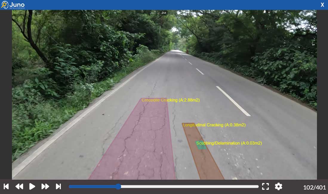
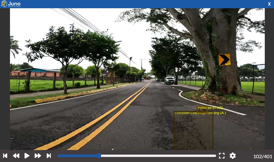
Road Fault Detection Model :This model utilizes advanced image processing and machine learning techniques to accurately identify and classify various types of road faults, such as cracks, potholes, and surface irregularities, ensuring comprehensive assessments of road conditions.
Assets
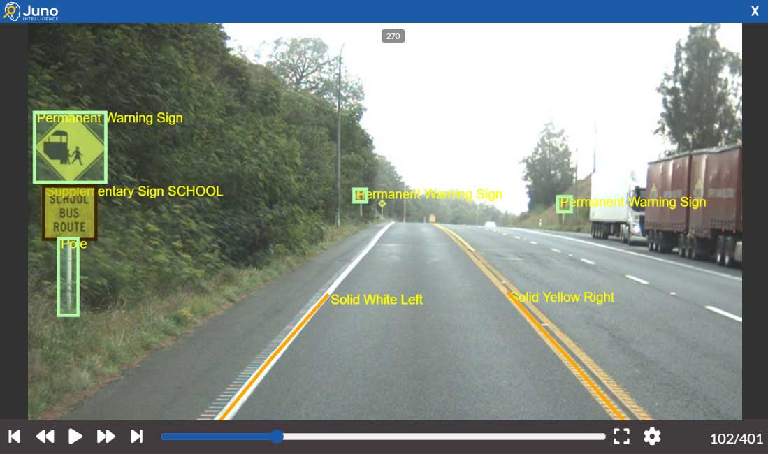
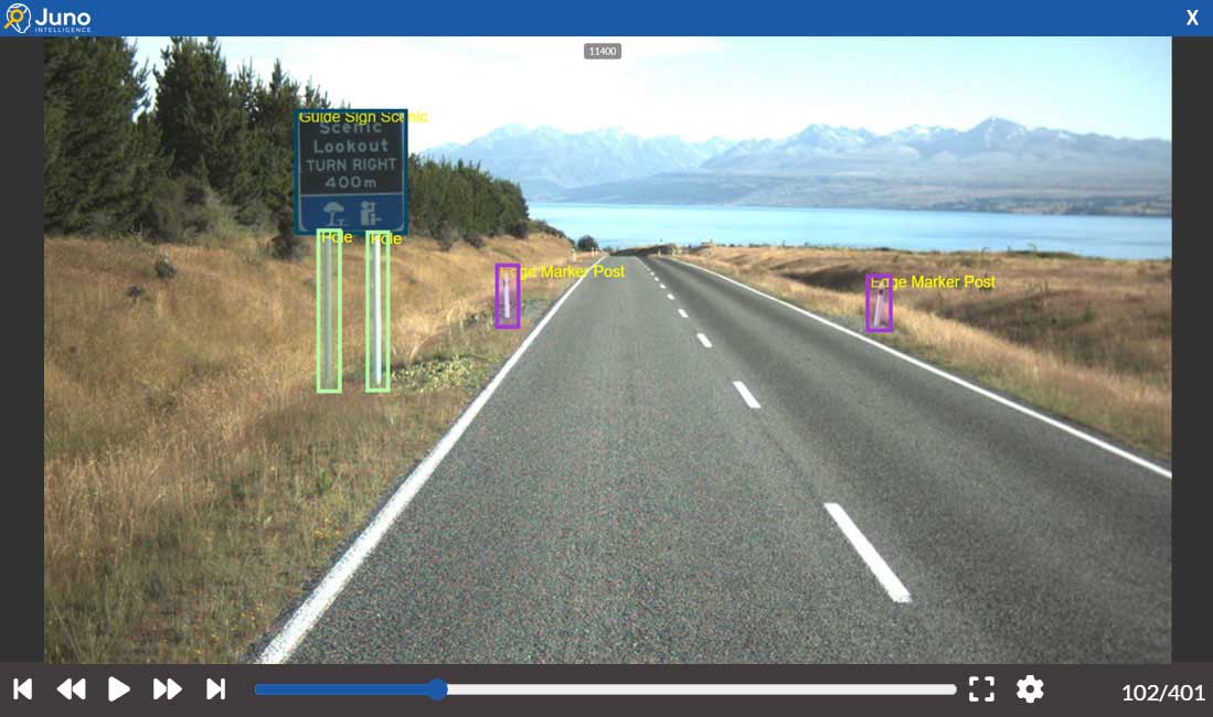
Off-Road Asset Identification Model :This model employs AI algorithms to detect and catalog off-road assets, such as signage, barriers, and utility structures, using visual data analysis to enhance asset management and maintenance planning.

Lane Marking
Linear Lane Marking Recognition Model :This model employs advanced computer vision techniques to identify and delineate linear lane markings while also assessing their health index. It provides accurate and reliable reporting of lane quantities categorized by type and location, facilitating effective maintenance and planning of road infrastructure.

Pavement Marking
Point Pavement Marking Detection Model :This model focuses on identifying and classifying point pavement markings, such as symbols and lettering, using image analysis. It aids in repainting programs, identifies ghost markings, and helps update and validate lane marking inventories.

JunoIntelligence Models
Faults
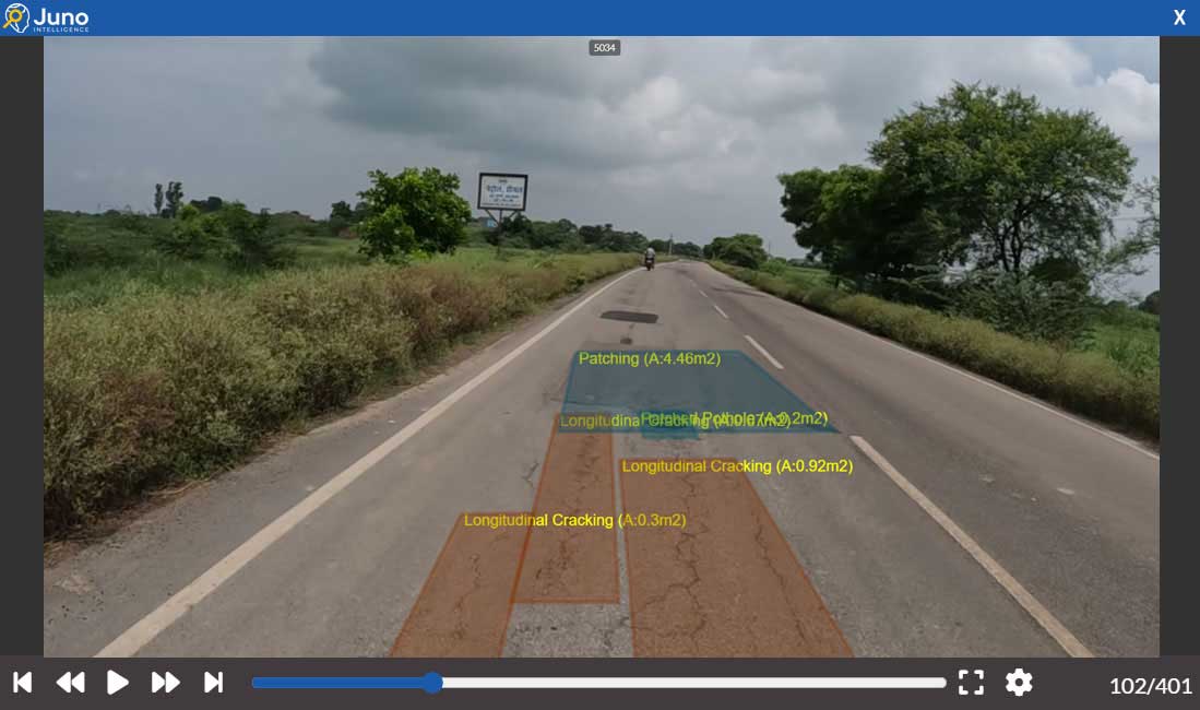
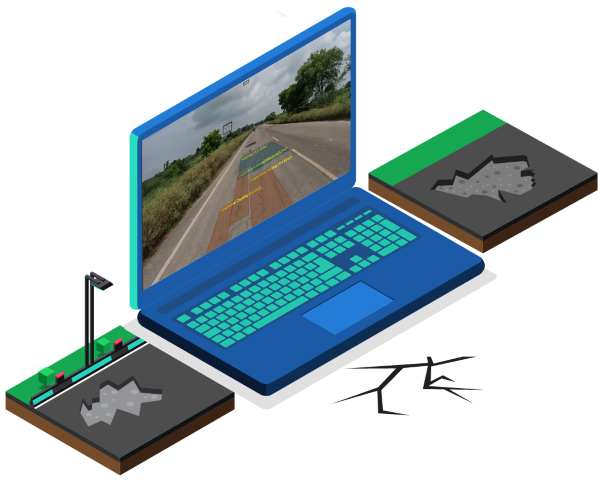
Road Fault Detection Model :The JunoIntelligence (JI) model utilizes deep learning and computer vision (CV) techniques to accurately identify a defined list of road defects, including potholes, scabbing, flushing, and various types of cracking.
By leveraging JunoIntelligence, users gain valuable insights into their network’s performance. The model provides detailed information on the quantity and types of faults at specific locations, supported by visual evidence. Additionally, it delivers metrics such as length, width, area, and wheel path information in its analysis and reports. This enables effective comparison and management of maintenance actions and facilitates tracking of network deterioration over time.
In the initial reporting, JunoIntelligence explicitly includes monitoring of wheel paths to identify areas of faster deterioration, providing immediate insights for maintenance planning.
For deeper trend analysis, JunoIntelligence offers a separate modeling functionality that utilizes machine learning to examine deterioration patterns over various time intervals, such as bi-annually or monthly. Users can analyze performance metrics for detour routes and assess trends influenced by traffic, weather, and maintenance history. This comprehensive analysis aids in improving treatment assignments and optimizing maintenance strategies.
Together, these capabilities allow for rapid and safe scaling of network analysis, empowering users to make evidence-based decisions that enhance the quality of road life and overall infrastructure management.
Assets
Off-Road Asset Identification Model :This model is designed to identify and catalog off-road assets within a transportation network.
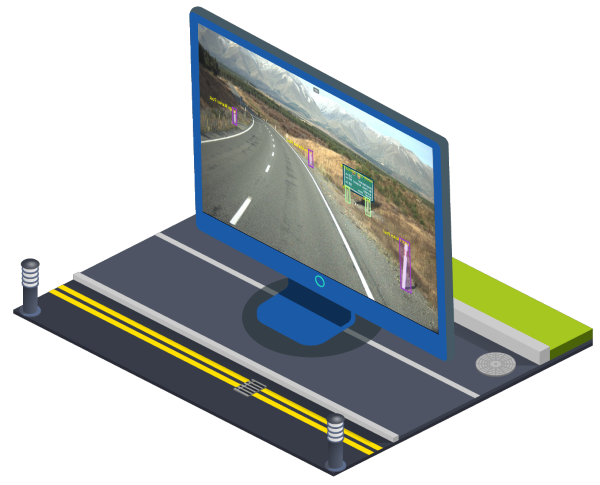
Many network managers lack visibility into the quantity, location, and condition of assets present on their networks. JunoIntelligence Assets addresses this gap by employing advanced machine learning techniques to detect a wide range of assets, including guide signs, traffic lights, barriers, speed limit signs, and more.
The asset model is capable of reading textual information and reporting defective assets, as well as determining their specific locations by lane. This functionality allows for accurate inventory validation and supports maintenance activities for defective assets, ensuring timely interventions and enhanced asset management.
With these capabilities, JunoIntelligence provides network managers with critical insights into their assets, facilitating better planning and resource allocation for maintenance and operational efficiency.
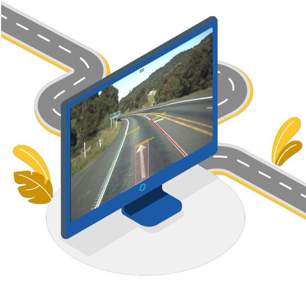
Lane & Pavement Marking
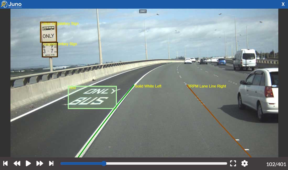
Lane and Pavement Marking Identification Model :This comprehensive model is designed to accurately identify and classify both linear lane markings and point pavement markings within a transportation network.
The JunoIntelligence model utilizes an expanding dataset of classifications to detect major linear lane markings, including:
- Yellow and white broken and solid lane lines
- Reflective Roadway Pavement Markers (RRPM)
- Median strip lane lines
In addition, it identifies point objects such as symbols, arrows, lateral shoulder bars, text, and cycle symbols. This comprehensive class list allows for a holistic view of road markings.
The model provides quantitative data on lane detections and assesses their condition, generating a health index rating. This establishes a ground truth for both lane and pavement marking quantities and health, enabling effective monitoring.
Through post-processing techniques, the model aggregates data into comprehensive reports. This information empowers network managers to identify markings with poor visibility, facilitating both proactive and reactive maintenance activities, including repainting and remarking.
Overall, the Lane and Pavement Marking Model enhances road safety and maintenance efficiency by ensuring that all markings are well-maintained and clearly visible to road users.
JunoIntelligence Features
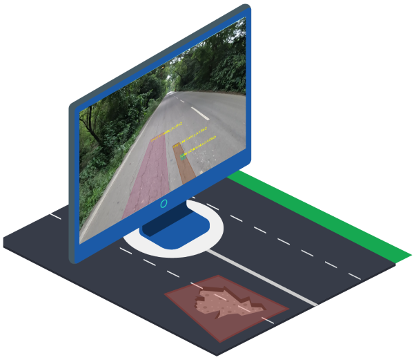
Calibrated Measurements
Fault Measurement Generation and Reporting :A key feature of JunoIntelligence is its ability to generate precise fault measurements, including area (m²), width, and length, with a high degree of accuracy.
The model computes measurements for each detected fault within defined bounding boxes. This detailed reporting enables clients to quantify the total area of detected faults, evaluate the extent of deterioration, and incorporate severity assessments, facilitating targeted maintenance interventions.
The inclusion of area, width, and length data provides significant advantages, such as:
Resource Optimization:Accurate measurements enable more effective resource allocation by identifying high-impact areas that require immediate attention, thus improving overall maintenance efficiency.
Cost Estimation:Detailed fault dimensions allow for more precise cost estimations related to repair or remediation activities, supporting better budgeting and financial planning.
Performance Analysis:Monitoring changes in fault dimensions over time can help assess the effectiveness of maintenance strategies and inform future interventions.
Pavement Condition Index (PCI) Calculation:The area measurements can be utilized to calculate the PCI, providing a standardized metric for evaluating pavement quality and performance.
Compliance and Reporting:Comprehensive measurement data supports compliance with regulatory standards and enhances reporting capabilities for stakeholders. Moreover, recognizing that budgets, networks, priorities, and maintenance management plans can vary significantly, JunoIntelligence offers flexibility in defining custom rules and views. This adaptability allows for more tailored reporting, leading to enhanced insights and informed investment decisions. Such capabilities are integral to the seamless integration of JunoViewer and JunoIntelligence.
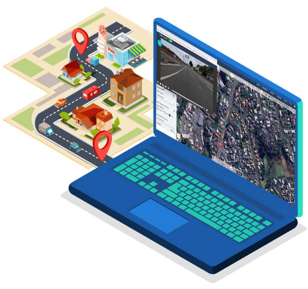
Localise data on the network
Network Data Localization:The JunoIntelligence platform enhances the value of its data by enabling users to locate identified objects within their road network, whether they are potholes, cycle symbols, or overhead signs.
While JunoIntelligence primarily operates on 2D imagery for object detection, the true power of this data is realized when users can visualize each identification in the context of their network. The integration of JunoIntelligence with JunoViewer empowers users to manage and plot all relevant data points or segments on their road network.
This capability allows for various visualization options that incorporate additional information, such as condition assessments and forward work plans, used in conjunction with the identified objects. By utilizing this combined data, users gain comprehensive insights into the state of their infrastructure, facilitating informed decision-making and effective maintenance planning.
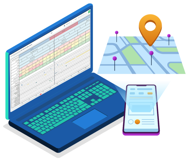
Visualise Data
Data Visualization:The integration of JunoIntelligence data with the JunoViewer Asset Management System allows users to view their data in various formats, including maps, strips, and video playback, alongside condition information presented in pullouts, graphs, or reports.
Users can generate heat map-style graphs based on the organization’s criteria to categorize severity levels effectively. This visualization aids in quickly identifying areas that require attention.
Additionally, users can customize data aggregation parameters for each JunoIntelligence class, facilitating tailored reporting and enhanced visualization of the data. This flexibility ensures that stakeholders can derive insights that are most relevant to their specific needs and operational priorities.

Interact with JI Data
At Lonrix, we believe that AI can effectively tackle the costly and time-consuming challenges associated with physical drive-overs for identifying and measuring road faults. Through our product, Juno Intelligence (JI), we can accurately detect road issues, assets, and lane markings from video footage with enhanced quality, efficiency, and cost-effectiveness.
Our advanced AI algorithms are designed to analyse vast amounts of data quickly, allowing for real-time insights that support proactive maintenance and timely interventions. This not only helps to improve road safety but also extends the lifespan of infrastructure by identifying issues before they escalate.
We recognise the crucial role of expert civil engineers in this process, ensuring that AI serves to complement their expertise rather than replace it. Their insights are invaluable in interpreting the data and making informed decisions based on the findings.
That's why the integration of JI and Juno Viewer prioritises user interaction and control over data outputs. Our cloud-based platform allows users to edit, delete, and add any AI-generated data anytime, anywhere. This flexibility ensures that the final dataset reflects the expertise of civil engineers while benefiting from the efficiency and accuracy of AI.
By harnessing the power of AI in collaboration with skilled professionals, we aim to revolutionise the way road maintenance is approached, ultimately leading to safer and more sustainable transport infrastructure.

Report on Data
Juno Intelligence provides clients with actionable insights through customizable reports, supporting informed decision-making.
Clients can tailor reports to suit their needs, from high-level network overviews to detailed section analyses. Section reports include images for each record, offering visual validation to enhance data reliability.
The intuitive interface makes report generation straightforward, with export options for easy sharing with stakeholders.
Juno Intelligence reporting empowers clients to optimize infrastructure management and improve safety outcomes effectively.

Data Centralisation
When integrated with JunoViewer, JunoIntelligence transforms into a centralised hub, consolidating all essential data for comprehensive road network management.
This centralisation empowers users to access and analyse accident information, condition trends (such as roughness, rutting, and skid resistance), maintenance history, surfacing details, and planned work in one place.
A centralised system enhances data analysis by allowing users to identify patterns, correlations, and trends more robustly across various datasets. This holistic view enables road and network managers to make data-driven decisions quickly and effectively, optimising resource allocation and enhancing road lifecycle management.
With maps, videos, and JI data all accessible from a single platform, JunoViewer offers a powerful, cost-effective tool for efficient, proactive road maintenance and management.
Gallery
Magnam dolores commodi suscipit. Necessitatibus eius consequatur ex aliquid fuga eum quidem. Sit sint consectetur velit. Quisquam quos quisquam cupiditate. Et nemo qui impedit suscipit alias ea. Quia fugiat sit in iste officiis commodi quidem hic quas.


